
Our SAR Stars
Every Friday, Sisters of SAR features the work, accomplishments and life of one exceptional women in SAR at any stage of her career. Below you will find all the SAR Stars featured so far.
If you are looking for Women in SAR, look no further.

Senior Research Scientist, NASA JPL
Dr. Cathleen Jones
-SAR for monitoring & understanding #hazards & transitioning methods for Earth science to operational agencies to benefit society


Applied Remote Sensing Scientist, FiniteCarbon
Camile Sothe
- uses EO data & ML to produce canopy height layers for forest carbon offsets calculation.

MSc Student - Urban forestry, Southern University, USA
Matilda Anokye
-Sentinel-1 in GEE to analyse flood trends
- model & prediction of wetland locations & SLR along the coast of Hawaii
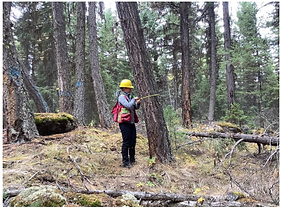
Remote Sensing specialist, B.C. Ministry of Forest, Canada
Sasha Nasonova
-forest inventory & landscape monitoring using LiDAR, Multispectral & SAR data with automation & cloud computing
- timeseries & change detection

Scientific Project Officer, JRC
Italy
Astrid Verhegghen
Sentinel-1 & Sentinel-2 for LULC monitoring in Europe & tropical regions of Africa
- Burnt area mapping with Sentinel-1

PhD Student, University of Pittsburg
U.S.A
Gabriella Zucco
- optical & SAR to study algal bloom extent, severity & causes in river networks
- subsidence analysis

Senior Research Scientist, John Hopkins APL
Heather
- ML for SAR for Arctic sea ice drift measurements
- optical & SAR for whiting detection in the Bahama Banks

PhD Student, University of Leeds
U.K.
Jess Payne
- land subsidence in Iran using EO & InSAR
- InSAR to construct time series & velocity maps of the extents & rates of subsidence

Scientist, ESA Climate Office
U.K.
Dr. Anna Maria Trofair
- Radar Remote sensing of the polar landscape using active & passive data
- technical officer for ESA managing various R&D projects for the cryosphere

PhD researcher, University of Reading, U.K.
Helen Hooker
flood forecast mapping using SAR
evaluation of spatial spread-skill of a full ensemble flood map forecast

EO Data Scientist, @CGI_NL
The Netherlands
Pavithra Raghunathan
-PS & DS in the estimation of settlements of Greenhouses in subsidence prone regions of NL
-EO + socioeconomic models for policy change in agriculture

Bahareh Yekkehkhany
- SAR & Optical data
- maritime surveillance, hazard detection, forest monitoring
-machine learning for agriculture

Technical Project Manager, Sparkgeo
Finland
Leticia/Letty Mendonca
- creator of the podcast #SARtastic Beasts and where to find them
- InSAR to study permafrost and wildfires in Arctic and Subartic Canada and Finland

Researcher, INAIGEM, Peru
Valeria Llactayo Peña
- determining the effects of precipitation in mass-balance gradients on the glacier Huaytapallana, Peru using Sentinel-1 and ground radar stations

Director ESA Earth Observation Programmes & Head of ESA ESRIN
Simonetta Cheli
Simonetta Cheli took up duty as Director of Earth Observation Programmes and Head of ESRIN (D/EOP) on 1 January 2022.
PhD Student, School of Earth & Environment, University of Leeds
Heather Selley
- Sentinel-1 to study changes in ice speed and loss in Antarctica

Postdoc at McGill University, Canada
Dr. Bindi Dave
-urban flash flood mapping from satellite images
- understanding the environmental impacts of infrastructure projects on flooding

Postdoc, NASA Goddard, USA
Dr. Cheryl Doughty
-climate change impacts in coastal ecosystems
- pairing data from the ground with remote sensing to answer ecological questions

Researcher, University of Salzburg, Austria
Dr. Zahra Dabiri
- method development
- detection & analysis of landslide-induced river course changes and lake formation
- monitoring land surface morphology
- Sentinel-1 for landslide volume estimation

PhD Student, School of Earth & Environment, University of Leeds
Sally Wilson
-subglacial lakes in East Antartica
-Sentinel-1 & machine learning to study ice velocitychanges in Antartica

Research Scientist, Biospheric Sciences Lab, NASA Goddard
Dr. Lola Fatoyinbo
-EO of vegetation structure, carbon stocks, state and land cover change
- LiDAR and SAR for coastal ecosystem structure and canopy height of Mangroves using TDX

Remote Sensing Technician, AAFC Canada
Amada Halstead
-RISMA coil moisture in situ data program used to build & validate SAR models & products

PhD Student, Dept of Geological & Earth Sciences, University of Miami, USA
Sara Mirzaee
Python programming, phase linking using joint persistent & distributed scatterers, assessing decorrelation models, systematic bias and unwrapping errors on InSAR time series analyses

PhD Student, Czech University of Life Sciences, Prague, Czech Republic
Arunima Singh
-LiDAR & SAR for forestry
-Sentinel-1 for forest classification using Random Forest
- Sentinel-1 & Sentinel-2 for forest areas analysis
PhD Student, University of Pisa, Italy
Diana Orlandi
-remote sensing for planetary geology
-paleo tectonics of volcanic areas on Mars & Earth

Solutions Owner, Fugro, The Netherlands
Dr. Pooja Mahapatra
-disaster Resilience Working group of WGICouncil member
- INSAR for subsidence

Satellite Solutions Architect, Satellite Applications Catapult, UK
Emma Hatton
-uses GEOINT data to support EO applications
- IUU fishing detection using Sentinel-1 & InSAR

Postdoctoral scientist, University of Osnabrück, Germany
Dr. Antara Dasgupta
-flood forecasting and monitoring through an integration of remote sensing, crowd-sourcing and physical & data-driven models

EO Scientist & co-owner Pixelytics
Dr. Samantha Lavender
detecting plastic waste (marine & terrestrial) using Machine Learning applied to Sentinel-1 & Sentinel-2
- co-author practical Handbook for Remote Sensing
Signal Analysis engineer NASA-JPL
Pasadena, USA
Dr. Virginia Brancato
algorithm development, inSAR, InSAR Time series, PolSAR, NISAR mission
- glaciar monitoring using DInSAR from Cosmosky-med
SAR specialist, Instituto de Estudos Avandas da Força Aérea Brasileira, Brazil
Tahisa Kuck
PITER-N (Real-Time Image Processing for Night autonomous air navigation), SAR for tropical forests, selective logging in the Amazon using CSX.

Regional Science Associate for
SERVIRGlobal, Huntsville, AL
Vanesa Martín-Arias
RTC product comparison project, SAR for Disaster rapid mapping, working on SAR-CB

Asst. Prof, Geospatial tech & Environmental sciences,
Concordia University, Canada
Angela Kross
multi-sensor (optical, lidar, radar) & multi-scale frameworks for local to global vegetation, ground measurements & models to answer questions related to ecosystem processes & land use change.

Research Scientist, IREA-CNR, Italy
Anna Balenzano
interpretation & modelling of microwave scattering from land surfaces, inversion of microwave data into land bio-geophysical parameters, integration of multifrequency & multiplatform SAR measurements for soilmoisture retrieval

Senior Teaching fellow, Dept. of Earth science & engineering, Imperial college, London
Phillippa Mason
translation of InSAR & imaging spectroscopy to assist in the understanding of geological features & processes on other Earth-like planets, such as Venus & Mars, science study team member of ESA's EnVision mission

3rd year PhD Student, Cyprus university of technology & Erathosthenes Centre of Excellence, Cyprus
Eleni Loulli
reflectivity data from the GPM of
NASA & ground-based X-band Radars to develop automated methods for estimating long-term precipitation over Cyprus
4th year PhD Student, Carleton University, Canada
Emily J. Lindsay
remote sensing applications for vegetation mapping & monitoring. Multitemporal Sentinel1 for classification of native grassland & seeded forage in southern Alberta.

Remote Sensing scientist, Vito Remote sensing, Belgium
Lisa Landuyt
EO projects related to water and coastal applications, deep learning & EO to support environmental policy makers in Flanders.
PhD Topic - Flood mapping from SAR using automated image classification techniques.


3rd year PhD Student, University of Northern British Columbia, Canada
Sara Darychuk
SAR for studying snowpack dynamics (when snow starts melting, how long it melts in watersheds), uses SAR timeseries minima as a proxy for snowpack saturation & examines the impact of slope, elevation, aspect, land cover and polarization on these estimates.

Research Scientist, University of Alabama Huntsville, NASA SERVIR coordination lead for Amazonia & Land Cover Land Use Change & Ecosystems Lead
Africa Flores
SAR Champion; First editor of the SAR Handbook; co-I of NASA funded project "SAR Remote Sensing Capacity Building Center", multiple webinars & trainings explaining basics of SAR & to lower the barrier to get access and process SAR for Ecosystem applications”.

Geospatial Scientist — SAR Specialist, Planet
Dr. Julie Nutini
Soil moisture prediction, soil moisture for prohibitive planting conditions using optical, multi-frequency SAR & Auxiliary data using ML, multi-frequency SAR & Machine Learning to predict NDVI.
MSc student University of Waterloo
Dept of Geography & Environmental mangement
Natalija Nikolić
Thesis focuses on the seasonal velocity variability of South Croker Bay and Belcher Glaciers on Devon Ice Cap using TerraSAR-X and RADARSAT-2

PhD Student, Glaciology, University of Waterloo
Danielle Hallé
Uses SAR to map & monitor the progression of melt across the Canadian Arctic Archipelago. Looking at hundreds of SAR images from Sentinel-1 & RADARSAT-2 archives to map glacier melt intensity to understand the impacts of climate change on glaciers & ice caps in the Canadian Arctic.

Chief Operating Officer, Carbon Mapper
Judy Lai-Norling
Locating, quantifying and tracking methane and CO2 point-source emissions from air and space; working to gather such critical data on methane and CO2 emissions.

Lecturer in Physical Geography, Department Leader for EDI at the University of Manchester
Dr. Polyanna Bispo
Geomorphometry, SAR & Lidar applied to forest conservation & ecology, ecosystem process &modelling, forest dynamic & disturbances, forest response to multiple environment stressors, Amazon & Brazilian Savanna Biomes.

Post doctoral fellow, VAW Glaciology ETH Zurich
Dr. Mylène Jacquemart
Main interests focus on natural hazards at the intersection with the cryosphere using #satellite & ground based InSAR, optical imagery & laser scanning.
PhD Student University of Nottingham,
Lead, SAR Capacity Building
Cristina Vrinceanu
developing automatic algorithms with Deep learning to detect and map natural oil slicks from SAR & multispectral data, co-lead of SAR capacity building Initiative.

Physical Scientist, Agriculture & Agri-Food Canada
Dr. Xianfeng Jiao
Building models and developing methodologies to extract information on crop type, crop growth condition, and crop phenology, all from Earth observation images, especially SAR.

Remote Sensing Consultant, Data Visualization Creator of the #ImagesoftheDay
Annamaria Luongo
Working with SAR imagery like Sentinel-1 for PSInSAR techniques & continues with project work on DG_DEFIS and CLMS user uptake & communication strategies; previous work focused on ground deformation, volcanic & seismic hazards, InSAR & Laser.

Professor of Data Assimilation,
Dept. of Mathematics & Statistics & Dept. of Meteorology, Univ. of Reading
Senior Fellow, Digital Technology for Living with Environmental Change
Dr. Sarah Dance
Data assimilation for applications in hazardous weather and flooding
Using SAR images in combination with a hydrodynamic flood inundation model to improve flood forecasts, predict how floods spread, estimate flood footprint for insurance loss adjustment & future flood risk management

Graduate student, University of Maryland
Shannan Jones
Studying geophysics with a focus on natural hazards; active tectonics, structural, and geomorphology. Using SAR & GIS to monitor surface deformation caused by natural disaster events such as floods, landslides, and wildfires, as well as anthropogenic geohazards.

Associate Professor, Universidad de Extremadura | UNEX · Department of Graphic Expression
Dr. Elia Quiros
Teaching remote sensing & GIS to the next generation. SAR to validate flood risk maps of different return periods; remote sensing for land cover-crop intelligent detection system - & applications of remote sensing in archaeology.

Senior Research Scientist, Michigan Tech Research Institute (MTRI)
Adjunct Assistant Professor, College of Forest Resources and Environmental Science (SFRES)
Dr. Laura Bourgeau-Chavez
Characterise and measure landscape ecosystems, fusion of SAR and multispectral data for mapping and monitoring wetlands and monitoring soil moisture for fire danger prediction in Boreal regions.

GIS Analyst, ILK Labs
Adithi Upadhya
Geospatial data analyst analyzing air quality, data analytics, spatial analysis & remote sensing.

Professor, Dept. of Geoscience & remote sensing, TU Delft, Netherlands
Project lead- Microwaves for Water in Vegetation (M-Wave)
Dr. Susan Steele-Dunne
microwave remote sensing to monitor the transport of water through vegetation from the land surface to the atmosphere in order to understand the role of vegetation in the water, energy and carbon cycles

PhD student, University of Victoria
Aikaterini Tavri
Polar region researcher, SAR Remote Sensing, multifrequency analyses & mapping of sea ice & melt ponds in the Canadian Arctic.

Post doctoral fellow, NASA JPL
Dr. Megan M. Miller
InSAR, geodesy, geophysics, and hydrogeology. Research interests include subsidence, landslides, tectonics, flooding & natural hazards, poroelastic modeling & inverse modeling.

Research Scientist, SERVIR Global
Research associate, University of Alabama Huntsville
Kelsey E. Herndon
Working with scientists & decision makers to design solutions to environmental challenges. Collaborator on the SAR handbook. Earth science, remote sensing, capacity building, & development.

PhD Candidate, Univ. of South Florida, Dept. of Geosciences
Tonian Robinson
monitoring sinkhole deformation using PSInSAR from TSX & Near-Surface Geophysics. Detection of millimeter-scale deformation using high-resolution #LiDAR data, ISCE2 & StaMPS MTI PS Processing

Assistant Professor, Department of Geography and Spatial Sciences, University of Delaware
Dr. Pinki Mondal
Remote sensing; Geographic Information System; developing geospatial methods for landscape-level monitoring and assessments; climate change impacts on agriculture in the developing countries.

Physical Scientist, Environment & Climate Change Canada
PhD Student, Carleton University
Co-lead, @SistersofSAR
Sarah N. Banks
Uses SAR for classification, change detection, time-series analysis of wetlands. PhD is focused on time-series analysis of Sentinel-1, NISAR & RCM SAR data. Passionate about teaching SAR & Random Forest classifiers
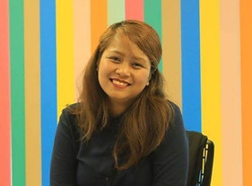
PhD Student, UNU Institute for Advanced Study of Sustainability
President, ISPRS Student Consortium
GEOMixer collaborator
Sheryl Rose Reyes
Using SAR to map mangrove extents and changes in the Philippines. Mapping landcover using optical and SAR in Coron & Busuanga, Palawan, Philippines.

Research associate, University of Alabama Huntsville
Mekong Regional Science Associate, SERVIR Global
SAR Capacity Building Lead
Andréa P Nicolau
Using SAR for forest loss & Land Cover Land Use mapping in the Peruvian Amazon. Contributor to the SAR Handbook. Sharing knowledge at capacity building trainings.

Director of Product Development, Climate Engine
Dr. Keiko Nomura
Mapping conservation opportunities by differentiating visibly similar tree crops using EO data. Identifying drivers of deforestation through analyses and stakeholder consultations.

PhD Student, Department of Geology, University of Salamanca
Yolanda S. Sanchez
Focuses on studying natural (erosion, floods, etc.) & man-made (forest fires, LULC) risks in the Jerte valley using remote sensing data. Using SAR to extract & estimate extents of water bodies from other land covers

Senior Researcher, CNR ISAC
Assoc. Editor, Int. J Applied EO & Geoinformation
Dr. Francesca Cigna
Observing Earth surface processes from space with SAR & InSAR. InSAR to monitor ground deformation & geohazards for land subsidence & slow moving landslides.

PhD Student, University of Waterloo
Social Media Ambassador, IEEE GRSS, IDEA
GEOMixer Collaborator
Victoria Vanthof
Using SAR for snow science & surface water hydrology. Utilizing remote sensing observations and modelling to inform water resource management under current and future climate projections

Remote Sensing Analyst, Remote Sensing Solutions
Contributor, @LadiesofLandsat
Dr. Flávia Mendes
Focusing on forest, agriculture & land use change in tropical forests using SAR & optical images. Champion of inclusivity & diversity in remote sensing.

PhD Candidate, Dept. of Geography, UCLA
Jessica Fayne
working to understand sources of measurement error related to physical interactions between Ka-band radar & open water & vegetative surfaces for the upcoming SWOT mission

Hindu Kush Himalaya Regional Science Associate SERVIR Global
Helen Blue Baldwin
Looking at forest stand height estimation using InSAR. Trainings for InSAR for forest stand height.Contributor to the SAR Handbook.

Scientist, SAtellite SArgassum Monitoring System (SASAMS_EO)
Dr. Betsa de la Barreda
Detecting & monitoring sargassum; analyze permafrost through timeseries analysis; #SAR for peatland assessment;

Research Scientist, Federal Agency for Cartography and Geodesy, Germany
Co-lead, @SistersofSAR
Dr. Gopika Suresh
developing methods for coastline monitoring from Sentinel-1, flood mapping from SAR, InSAR for earthquake deformation analysis, SAR for Land cover classification, Copernicus for SDGs

Research Scientist, Agriculture & Agri-food Canada
IEEE GRSS IDEA Committee & Women Mentoring Women
Dr. Heather McNairn
Lives & breathes #SAR, knowing these data offer critical information to help #agriculture meet productivity & environmental goals.

Researcher, Institute for the electromagnetic sensing of the environment IREA-CNR
Dr. Simona Verde
Focusing on developing & testing SAR data processing, multi-baseline D-InSAR & SAR Tomography algorithms

PhD Student, University of Victoria
Imaging large earthquake ruptures in space and time using InSAR data and modelling, satellite optical image correlation, and back-projection seismology

Dr. Mariko Burgin
Mission formulation and novel mission concepts for Earth & Mars, EM modeling of land & ocean surfaces on Earth & Mars with large-scale ML processing techniques using SAR & radiometer, optical & other sensors, global algorithms for soil moisture & sea ice retrievals & marine debris detection using P-, L-, C-, & X-band SAR data

PhD Candidate, University of Reading & The James Hutton Institute
Linda Toča
Uses #SAR data to assess peatland ecosystems. With Sentinel-1 she is looking at pristine, damaged & restored peatlands. She hopes improve the understanding of peatlands & encourage SAR usage for peatland monitoring.

PhD Student, Dept. of Earth Sciences, University of Oregon
Becca Bussard
InSAR for surface & sub-surface processes at #volcanoes. Understanding long term subsidence of Pycroclastic flow deposits from 1980 Mt. St. Helens eruption using InSAR. Studied persistently restless Telica volcano with InSAR from COSMO_SkyMed

Researcher, Funvisis, Venezuelan Foundation for Seismological Research
Gabriela Quintana Sánchez
Using #DInSAR, #PSI & #changedetection to study crustal deformation in #Venezuela from active faults, subsidence & landslides

Associate Professor, Remote Sensing & GIS, University of Gothenburg
Dr. Heather Reese
Mapping Land Cover in the Amazon, US, Africa & Sweden. Multi-Source Remote Sensing including SAR to map changes in N. Sweden Palsa Mires w/ Drone Photogrammetry, Lidar, Sentinel-2 & DInSAR

Associate Professor, Università di Pisa
Dr. Carolina Pagli
Fascinated by volcanoes, earthquakes & glaciers. Using InSAR, GPS & seismicity to study active volcanoes & fault kinematics & studied the Vatnajökull icecap's recent retreat using GPS & FEM modelling.

Geospatial Researcher, SINAG: Solar PV Resource and Installation
Ma. Divina Angela Bauzon
Interests include SAR products for Coastal applications & Geodesy in Geodynamics. Post earthquake shoreline detection in West Bohol Philippines using Sentinel-1 SAR & Remote sensing techniques

Outstanding @SistersofSAR Contributor
Orla Sheridan
Monitoring flood inundation on the island of Bhasan Char using SAR & GEE using Sentinel-1 data


PhD Student, SUNY-ESF
Rabia Munsaf Khan
Focused on fresh water quality monitoring. Multi-sensor & machine learning to detect sediment in fresh water lakes, particularly looking at Sentinel satellites. Utilizing NN to classify landcovers.
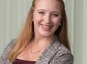

Pennsylvania State University
Dr. Kirsten Stephens
InSAR & timeseries analysis for studying the Masaya caldera & Telica stratovolcano in Nicaragua. Assessed the potential of current empirical & predictive methods for mitigating tropospheric noise from interferograms.


Associate Professor, Department of Environmental Science, Policy & Management, Rausser College of Natural Resources, UC Berkeley
Dr. Iryna Dronova
Combining field ecological methods & remote sensing, GIS & spatial analysis to analyse multi-scale structure of ecosystems, to facilitate scaling of ecological processes from local to regional levels.

VP Analytics, ICEYE
Dr. Shay B Strong
Building a team of scientists for leveraging HR SAR imagery for natural catastrophe assessment; using LiDARs for profiling aerosol content in the atmosphere; built a geospatial machine learning team focused on deep learning for water resource and natural catastrophe management.

Physical Scientist, Agriculture & Agri-food Canada
Co-lead, @SistersofSAR
Dr. Laura Dingle Robertson
SAR & optical data to identify condition & changing states of soils & crops focusing on Compact Polarimetry, Multi Frequency SAR, Quasi polarimetric, & Coherence Change Detection.

Earth Observation Engineer & Project Manager, GMV
Dr. Elsa Carla D
Using SAR for projects including flood mapping; infrastructure assessment; landcover mapping & others! Developing & testing novel approaches to extract forest structure information from combination of InSAR/LiDAR & wavelet space-scale analysis.

Physical Scientist, Environment & Climate Change Canada
Lori White
Using multi-frequency and compact polarimetry SAR to monitor wetlands. Focused on multi-temporal & multi-sensor wetland classification using RADARSAT-2, TerraSAR-X & Landsat-8.


Post doctoral research fellow, British Institute in Eastern Africa
Dr. Pamela Ochungo Mulaku
Using Sentinel-1 fused with Sentinel-2 to map potential honeybee habitats in Kenya. Using multi-platform, multi-band, multi-polarization, high resolution SAR systems, Machine Learning classification algorithms for detecting archeological sites & monuments

Professor of Remote Sensing, School of Geodetic Engineering, University of Zulia
Ileanis Arenas
Working with worked with InSAR techniques for subsidence & for DEM generation in Venezuela. Very interested in passive & active remote sensing data & its applications with other sciences.

Lead Earth Observation Scientist, Digital Earth Africa
Dr. Fang Yuan
Bringing ARD SAR into the Open Data Cube platforms for Australia & Africa. Building an operational platform in Africa that will provide free & open Earth Observation data to support Africa’s sustainable development goals.

Professor for AI & Data Science in Earth Observation @DLR_de & @TU_muenchen; @Zhu_xLab
Dr. Xiaoxiang Zhu
Remote sensing and Earth observation, Signal processing, Artificial intelligence and machine learning, Data Science. Application focus - global urban mapping.

Post doctoral fellow, University of Alaska Fairbanks
Dr. Helena Bergstedt
Focusing on permafrost, freeze/thaw cycles of Arctic & Alpine landscapes using SAR & scatterometers. Developing methods to derive a frozen area fraction from coarse scale scatterometer data using Sentinel-1 time series.

Graduate Student, University of Ferrara
Martina Natali
Compared ground truth data of soil moisture content from gamma ray spectroscopy (a nuclear physics technique) with backscattering data from Sentinel-1. Wants to find a site-specific linear relation between soil moisture & 𝜎^0 to estimate soil moisture using only Sentinel-1 data from 3 different orbits.

PhD Student, Cornell University
Kelly Devlin
Looking at InSAR processing techniques over agricultural areas, especially areas of groundwater extraction. Current project is evaluating filtering & unwrapping techniques on data over the Central Valley, CA

Research Scientist, Global Water Futures, University of Waterloo
Dr. Kiana Zolfaghari
Involved in the lake monitoring project & applied AI on long time-series datasets of RADARSAT-1, RADARSAT-2 & Sentinel-1 data using the GEE downloading module; Applied AI on a combination of RADARSAT-2 & numerically-modelled data to improve soil moisture products for a crop disease risk assessment web tool;

GIS and Mapping Specialist, British Antarctic Survey
Laura Gerrish
Uses Sentinel-1 to digitize the edges of ice shelves especially after a large iceberg has calved. This updated data is fed into other datasets such as the coastline file in the SCAR Antarctic Digital Database. Working with others to automate the extraction of features from SAR imagery.

Post doctoral fellow, Geological & Planetary Sciences, Cal Tech
Dr. Yujie Zheng
Developing new techniques using combinations of geodesy & InSAR to understand Earth’s surface changes related to natural & anthropogenic processes; assessed closure phase errors & systematic bias in multi-looked InSAR data & combining InSAR with physical models

Geoscience PhD Candidate, Penn State
Judit Gonzalez Santana
focuses on flank instability processes at Pacaya Volcano using InSAR time-series to quantify volcanic flank motion & analytical methods to model likely sources of the ground deformation & identify magma-tectonic interaction.
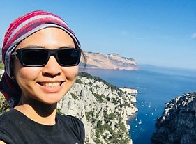
Post Doctoral Fellow, NASA JPL
Dr. Grace Bato
Early career PDF at NASA JPL using #InSAR to study Volcanos.
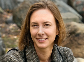

Assistant Professor, Carleton University
Dr. Koreen Millard
Multi-sensor data fusion for improved understanding of hydrology/vegetation change, modelling spatio-temporal biophysical variables with time-series remote sensing & field-measurements; ML for mapping environmental change.

InSAR Application Engineer, SkyGeo
Jennifer Scoular
InSAR Application Engineer at SkyGeo. Formerly PhD student at Imperial College London

SAR Specialist
Dr. Paula Burgi
Studying the bias introduced by vegetation on InSAR data; detecting land surface change and tectonics; looking at soil moisture using InSAR on the Arabian Peninsula.


Professor, National University of San Martín (UNSAM), Buenos Aires, Argentina
Dr. Natalia Morandeira
Landscape ecology and wetland plant ecology, aided by remote sensing and Geographic Information Systems tools.

Nominate a #SAR STAR TODAY
DM us on @SistersofSAR on Twitter
OR
Email us at: sistersofSAR@gmail.com
if you would like to be a #SAR STAR or know someone who we should feature.